
Japan Long Distance Hiking: Tokaido Trail Part 3

Cresting a mountain pass on the Tokaido Trail
This is Part 3 in a series on long distance hiking in Japan on the Tokaido Trail. Part 1 focused on planning and logistics and Part 2 on the experience of hiking the trail.
The Tokaido Nature Trail winds to the top of peaks and hills, which can be great for views, but abysmal for water. This summer, as I hiked the Japanese long distance trail, I spent hours wondering how it can be so hard to find water in a country where it rains so often. I once went 30 miles over the course of a day without crossing a water source. Even the shelters (check the next post) were not placed near natural (or even well) water. Long distance hiking in Japan certainly had some familiar features of trails I had hiked in the US, yet it was clear Japanese trail designers have different goals than American trail designers.

Even in remote places, trail maintenance in Japan does not always emphasize the use of natural materials
Much like the Long Trail in Vermont, the Tokaido Nature Trail, travels high on ridges on rocky, rooty terrain. Instead of switchbacks and contour lines, the trail ventures forward by scrambling straight over each hill. In several places, the trail was so steep that previous hikers have tied ropes to trees and roots to make it possible to shimmy up the hillside.
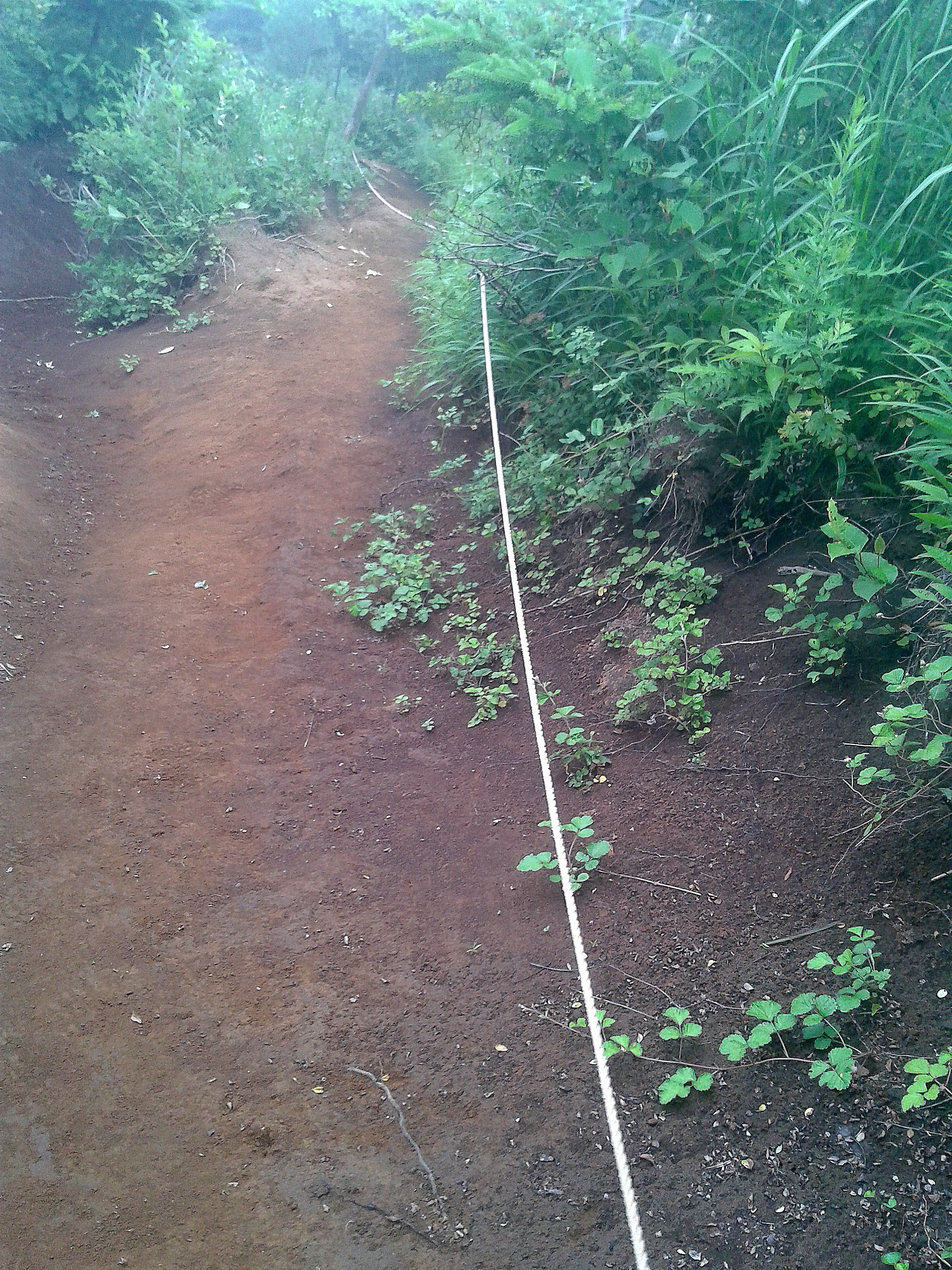
Sometimes, hikers use ropes to get up particularly steep and featureless sections of the trail where feet are not likely to stick to the slippery clay soil
The trail can be as rocky as the Appalachian Trail in Pennsylvania, but without the stability that keeps PA’s rock more-or-less glued in place. It seemed like water bars are non-existent. Instead, trail maintainers put their efforts to reinforcing steep, erosion prone hillsides with trail over steel-clad bridges and secured planks. On American trails, maintainers try to use natural materials such as rocks and logs to fortify routes. In Japan, there is not as much pressure to uphold a wild look.

Something that looks like a warning sign lets me know something is not right ahead.
When I reached one road crossing, it became clear that a landslide had taken out the pavement leading to the trailhead. I roadwalked on deserted asphalt, passing abandoned former tourist attractions. Some construction guys were stationed near the closed public bathrooms that I had been counting on, not so speedily trying to repair the damage. With the remote road out, however did I get there?

A landslide took out the trail
When I got to the trailhead, it was covered in hastily placed paper signs that I couldn’t read (except for the red exclamation points at the end). It was pretty clear that the trail was either closed or rerouted ahead. I was worried. My maps only covered the narrow area right around the trail. Even if I did find someone who could send me in the right direction, unlikely given the sheer remoteness, I didn’t even know the name of the next place I was trying to go. The only word I could read on my map was “mountain.”
Luckily, pink flagging marked a trail reroute around a landslide.

Made it past the landslide and onto the mountain pass