
Why the Boundary Trail could be the next John Muir Trail
No permits. No people. No roads. No bear cans requirements. Could the Boundary Trail be the uncrowded alternative to JMT?
I recently hiked the ~115-mile long Boundary Trail across the Pasayten wilderness in Washington. It became clear that this one to two-week backpacking trip along the U.S.-Canadian border has the potential to be the next John Muir Trail—the wilderness backpacking trip everyone wants to hike.

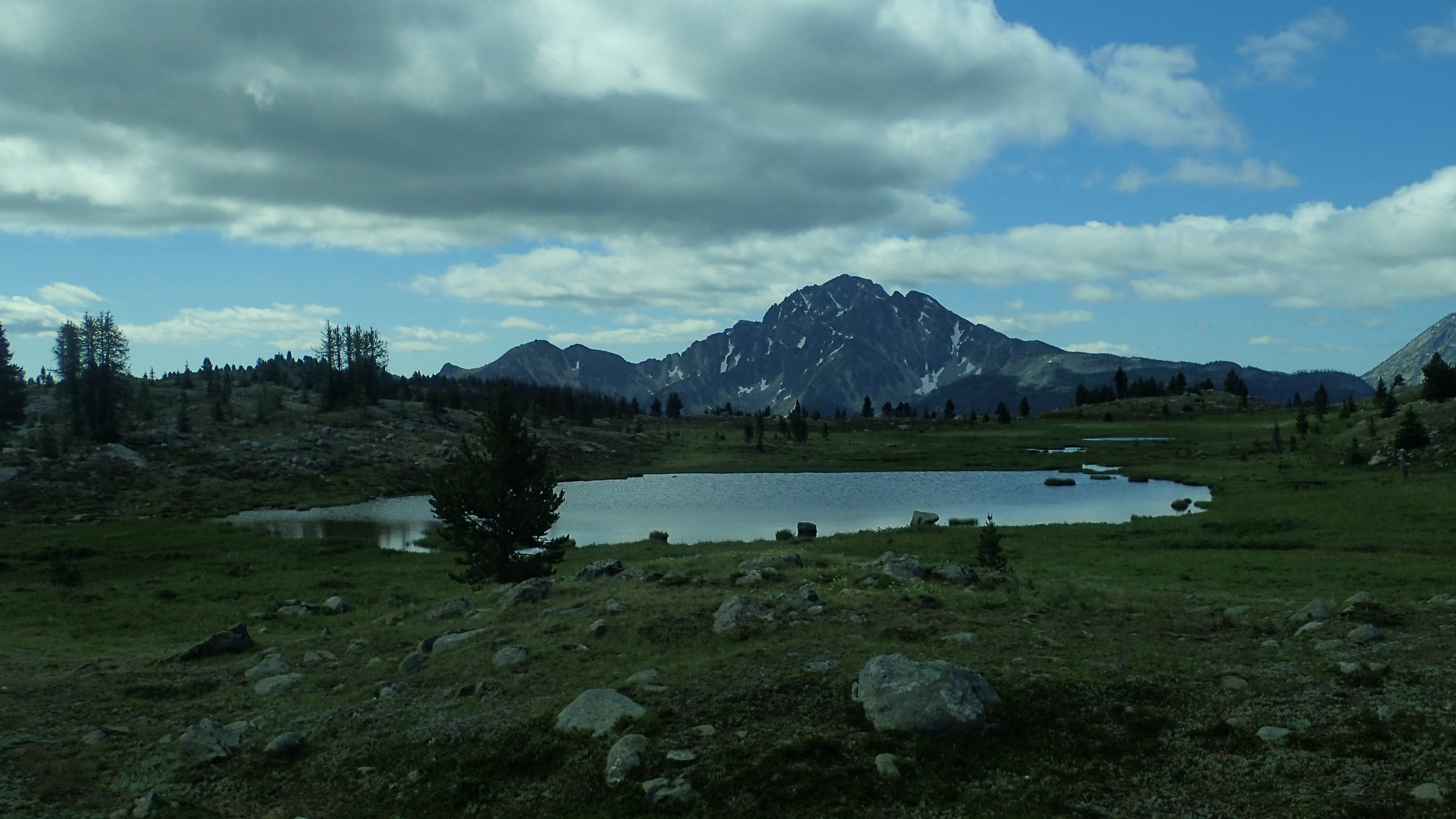
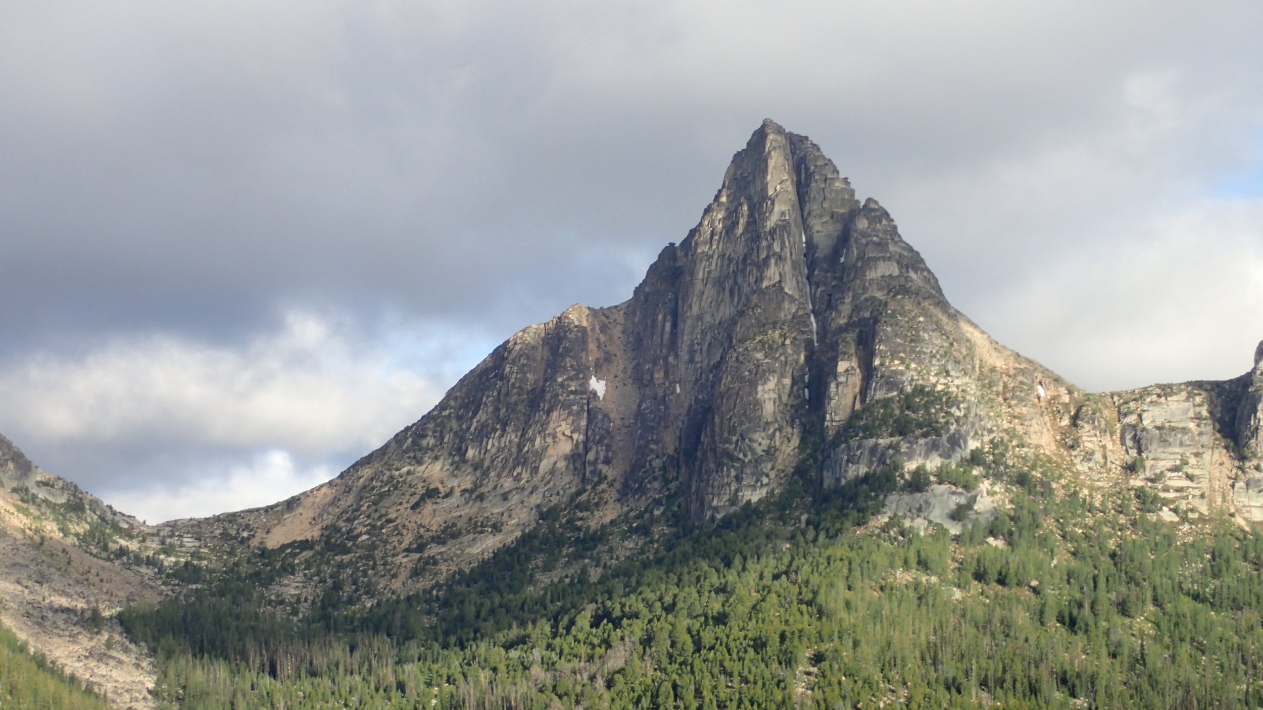
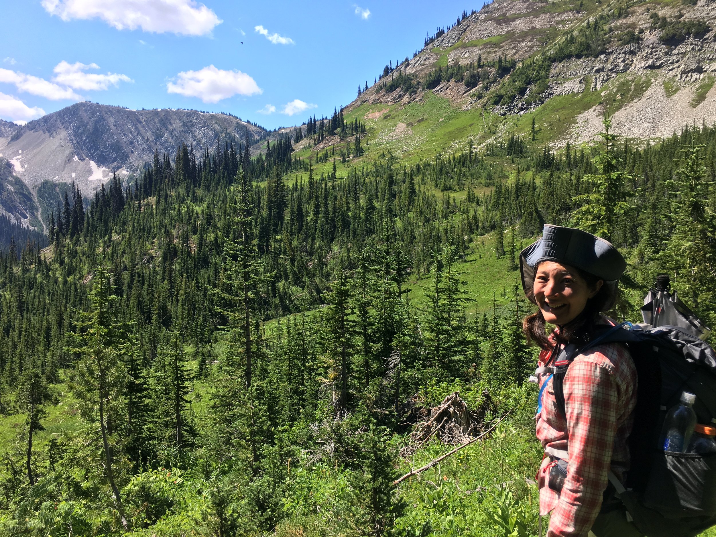
Incredible views abound on the Boundary Trail
Photograph by Liz Thomas
What makes the Boundary Trail like the John Muir Trail?
First, an analogy:
The John Muir Trail is to the Pacific Crest Trail
As The Boundary Trail is to the Pacific Northwest Trail
Both the JMT and BT are one to two week thru-hikes in the middle of a looooonger thru-hike. And both trails are considered by many to be the crown jewel of that longer hike.
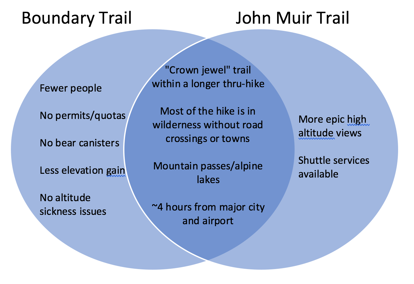
Both the Boundary Trail and JMT have mountain passes, alpine lakes, and incredible mountain views. The JMT is a ~214 mile hike across a roadless wilderness. The BT, when connected with the Pacific Northwest Trail, it is a 115-mile long across a roadless wilderness.

What makes the Boundary Trail “better”* than the John Muir Trail?
The JMT has a reputation for being crowded, loved-to-death, and impossible to get permits for.
The Boundary Trail doesn’t have crowds (we saw one party of hikers).
It doesn’t require permits. It has no quotas. It has no bear can requirements.
Even though the Boundary Trail goes over mountain passes, it has less elevation gain than the JMT.
It’s at a lower altitude, too, so you are less likely to get altitude sickness or altitude-induced sluggishness.
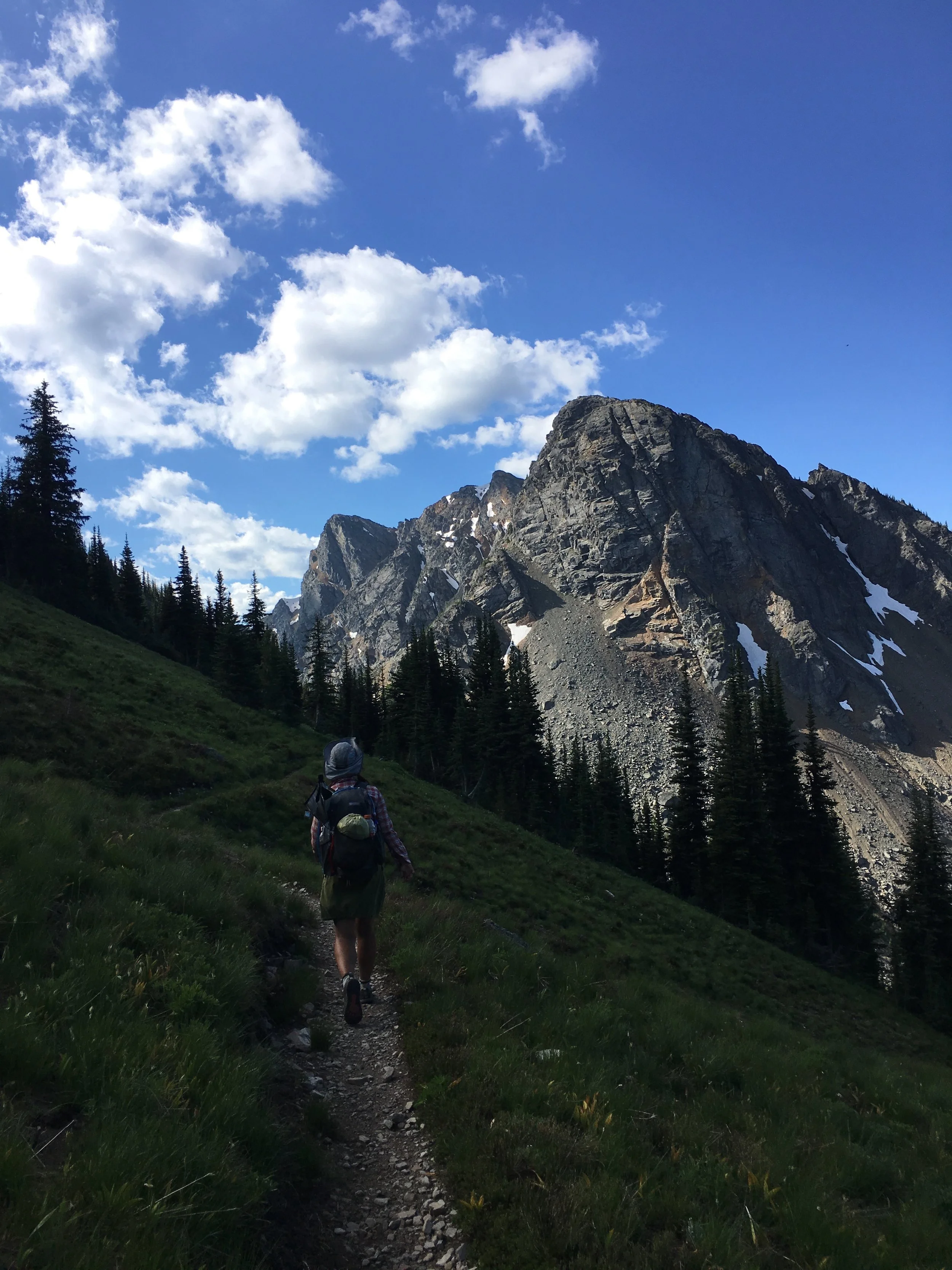
Officially, the Boundary Trail starts at Iron Gate trailhead and goes ~7 miles over Sunny Pass to Horseshoe Meadow. To turn this into a longer, wild, roadless wilderness backpacking trip, we started the Boundary Trail by approaching it from the Pacific Northwest Trail at Cold Springs Camp, which 3 miles to that distance.
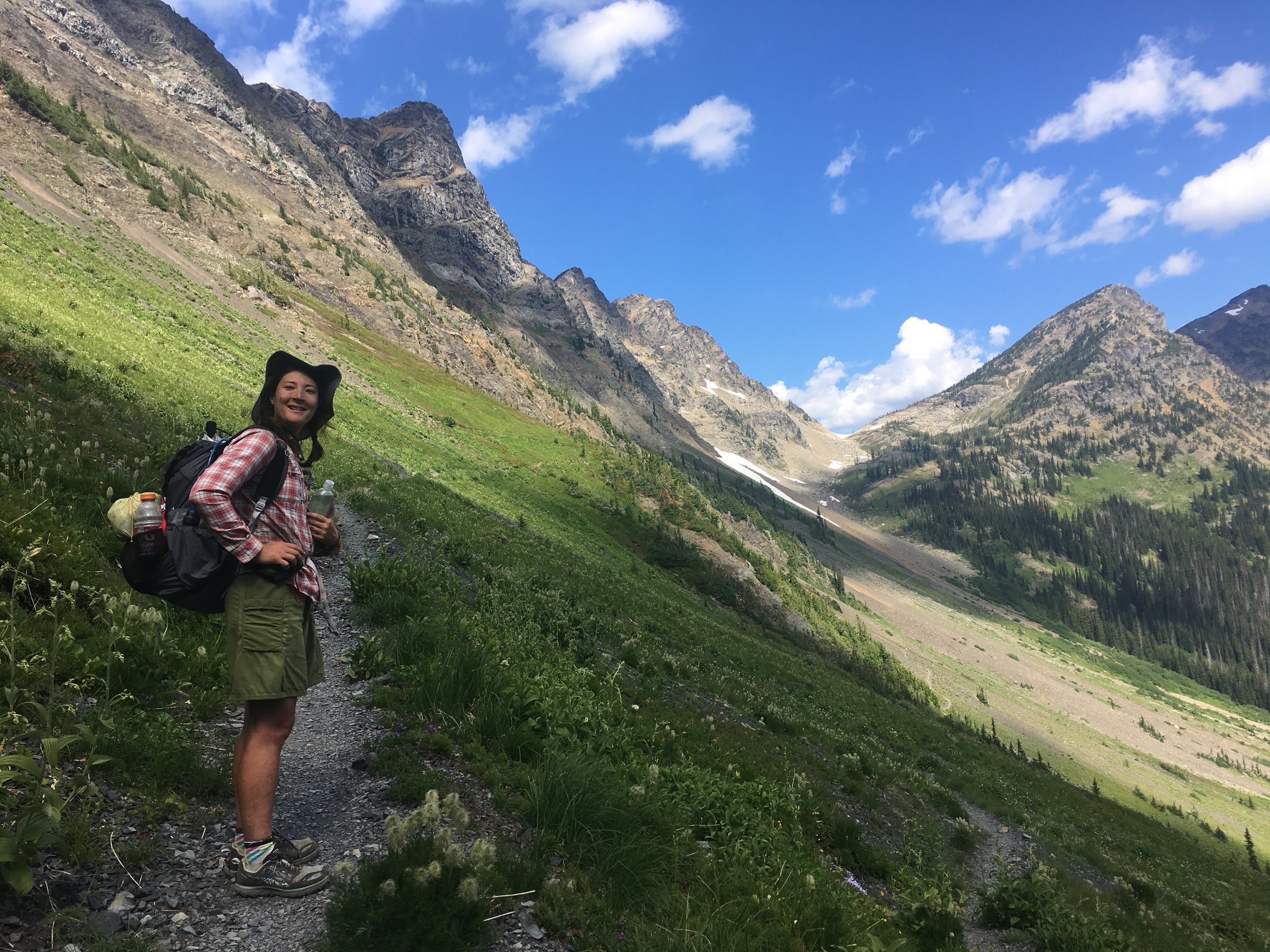
After “finishing” the Boundary Trail at the PCT, we decided to extend the trip for another three days by joining the PCT for 13 miles. Then, at Holman Pass, we turned off the PCT onto the Pacific Northwest Trail and headed west. That took us all on trail through roadless wilderness to the top of Devil’s Dome with FANTASTIC views of Jack Mountain. Our descent had incredible views of North Cascades National Park and Ross Mountain National Recreation Area.
Like any good long distance trail, the Boundary Trail comes with its challenges.
First, figuring out how to shuttle your car between trailheads is trickier than on the JMT. The pricy shuttles or convenient series of bus rides you find on the JMT are almost non-existent for the BT for now. But since most traffic in the area will be headed in the right direction, you should be able to get a ride if you’re willing to hitch.
Next, the Boundary Trail is a remote trail. It’s so far from roads that trail maintainers may not get a chance to get in there every year. A few fires in the past have taken down trees. You’ll definitely encounter a wilder and less manicured trail conditions than on the JMT. So make sure you are physically and mentally in the space to be able to take on these challenges.
Lastly, I actually think the fords on the JMT are scarier than on the Boundary Trail. But I feel like I do need to mention that the BT doesn’t have bridges over creeks and rivers. Still, I found the fords to be far less intimidating than the JMT’s Evolution Creek, Bear Creek, or the South Fork of the Kings River. I even found some strategic logs to cross!

The Boundary Trail is one of those under-the-radar long distance backpacking trips that should be on more hikers’ lists.
For more resources on the Boundary Trail:
The Pacific Northwest Trail Digest 2018 by Tim Youngbluth has the complete route description for the Boundary Trail from Cold Springs Camp to Ross Lake National Recreational Area and is the most recent printed data on the Boundary Trail
Washington Benchmark Road Atlas: High-quality map shows rural, dirt, and Forest Service roads to trailheads that don’t always show up on Googlemaps. More accurate and more recently updated than the DeLorme road atlas for Washington.
*I don’t really think there is such thing as a “better” trail than others. It just depends what you’re looking for in a trail, your mindset, and skills and abilities. But in this context, I mean “what advantages does the BT have over the JMT for what most hikers are looking for in a trail.”