
Taking trail back from the runners: Grand Canyon Rim to Rim to Rim

My friend Pi on a narrow part of the beautiful North Kaibab Trail down from the Northern Rim of the Grand Canyon.,
A classic must-do test-piece for ultra-runners, traversing the Grand Canyon from South Rim to North Rim to South Rim again is rarely within most hikers’ consideration—and perhaps wrongly so. The Rim-to-Rim-to-Rim in a day is a hiker’s paradise—well constructed trail, unmatched trail placement (clearly routed to give maximum views), and the ultimate lesson in geology. In one day, hikers can see one of the greatest natural treasures in the U.S. without a permit, much planning, or a heavy pack. This week, I took on the challenge long the realm of runners—and undertook it from a hiker’s perspective: I did what the signs warned me not to do and walked from the Rim to the Colorado River—twice.

Signs at the trailhead and for several miles down the Bright Angel Trail warn hikers not to do HALF of what I attempted
Prospective Rim-to-Rim-to-Rimmers must time their trips within two month-long windows; a hiker traveling too early might expect waist deep postholing (sinking waist deep in snow, removing foot, taking a step, repeating) and a hiker traveling too late will have the Canyon’s infamous heat to contend with (and vice versa for fall travelers). The path is scattered with water fountains (Yes! Actual drinking fountains!) every 6-10 miles making the trip tailored to the runner and dayhiker. Two paths allow hikers to walk from the South Rim to the Colorado River—the longer but wider and gentler graded Bright Angel Trail and the scenic and shorter South Kaibab Trail. Famous hiker Andrew Skurka built a spreadsheet in hiker databook form that explains the distances on all these trails (note: Skurka’s guide omits Supai Tunnel drinking fountain 2 miles from the North Rim).

Early morning at the Colorado river
My friend Pi and I started the hike at South Rim on the Bright Angel Trail early. We made it down, crossed the river, and found that, for 6 AM, Phantom Ranch was surprisingly active. Sadly, it was too early to buy lemonade from the camp store.

The trail crosses at least six bridges on the northern part of the canyon
The walk from Phantom Ranch follows and crosses a creek to Cottonwood Camp on trail that is almost flat. The path splits once before Cottonwood with a sign pointing right to a waterfall and an unmarked trail going left. The two forks meet after half a mile, although the trail left requires two fords and is slightly longer. The waterfall trail doesn’t actually go to the falls, but goes uphill to a view and then back down. Choose your poison.
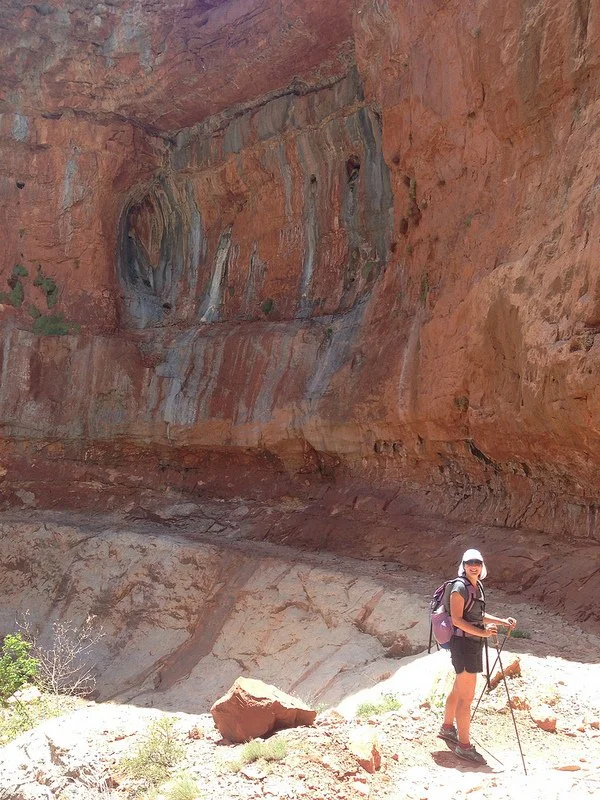
Get out your LT4 hiking poles! There are better places for those afraid of heights.
After Cottonwood Camp, the trail becomes stunningly beautiful. The route narrowly skirts red rock cliffs and climbs precipitously. For me, the truly hard part of the whole trip came after the Caretaker’s cabin (be sure to get water here!), as the path becomes sun exposed and the grade gets steeper. Although the North Rim had not yet opened to the public while I was in the Canyon, trail crew were busy restoring the northern canyon trail.

I made the mistake of assuming that the telegraph wires that parallel the trail from Phantom Ranch terminate at the North Kaibab trailhead—the same place where I would reach the North Rim. Instead, the wires veer off, presumably reaching the rim miles before a hiker will. I was fooled and a little disappointed that my uphill was not yet over. The last two miles from the water fountain at Supai tunnel (an actual tunnel in the rock hikers walk through!) were the steepest, but enjoyable due to the shady trees that lined the trail. As I reached the sign for the North Kaibab Trailhead, I felt an overwhelming wave of accomplishment. Even though I was only half way through my journey, I knew the hardest part was done.

The trail goes through several tunnels, including Supai tunnel (with water fountain nearby). Spend some time in the rocky shade here!
On the way down, I could enjoy the scenery more without the distraction of the physical exertion of the uphill. I saw several ultramarathoners coming up (including Rob Krar, who passed me at Phantom Ranch and near Cottonwood Camp on his way down as he attempted to beat the speed record on Rim-to-Rim-to-Rim of 6.5 hours). I also spotted several heavy packing backpackers going from camp to camp.

Amazing descent down the canyon
The climb up from the Colorado River back to the car was a highlight of the trip. As the sun lowered, the late afternoon rays hit the red cliffs as I ascended the trail swirling upwards to the rim. I topped out as the final glimmers of sun were disappearing with the fortune to have a band of teenage tourists cheering me on.

As the sun goes down in the distance, the canyon walls shaded me on my ascent back to the South Rim
The Rim-to-Rim-to-Rim was not my longest dayhike or my greatest elevation gain in a day, yet it was a fantastic trip for both scenery and physical exertion. I hope to be fortunate enough to do it again via a different route, the shorter but more scenic South Kaibab Trail.
Rim-to-Rim-to-Rim in a day is hard, even for ultra-runners. (Of the ten Rim-to-Rim-to-Rim runners I saw, only about half passed me. Late in the day, I saw a helicopter come to the Colorado River. I hope it wasn’t to bail someone out.) Yet, I learned that the trip is doable for fast and light hikers, even people like me who obstinately refuse to run. Packing light, having ultralight backpacker efficiency, and possessing long distance backpacker endurance gave me the edge to conquer a trip usually only attempted by people whose mile per hour speed exceeds mine.