
Portland Urban Hike Day 1: Southwest

Portland Hike: Day 1
Starting Point: The most southwest corner of Portland near PCC Sylvania
End point: Sellwood near Oak Bottoms
Mileage: 19.2 miles
Many locals don’t know how far south and west Portland City Limits actually goes. We started by Portland Community College Sylvania—quite near Tigard. Almost right off the bat, we got to travel on muddy trail through the forested Lesser City Park up to the campus—and then from there, do a little “cross country” hiking through a forest on the college’s property down to G Street.

To prep for the hike, I bought the infographic maptacular book Portlandness, a cartography geek’s dream created by two geography professors at PSU. The profs ran stats showing that Portland has way more unpaved streets than other Cascadia towns and I told Virgo, who is thru-hiking and filming the trip, “I really want to see some of these 4WD city streets!” Who would’ve thought that I’d find what I wanted so quickly into my hike?
The SW Trails Association has put together this great routes that serve like “bike routes” except for walkers. They take advantage of trails, stairs, and hidden alleys where only those on foot can go. I frequently found that although I hadn’t consulted with the SW Trails guide to map my trip, I was often on one of their routes.

I’m convinced not only is Portland the land where young people go to retire, but also where school age children go to retire. Despite walking on the fantastic stairway down to Jackson Middle School at 10:30 am, kids seemed to be going to coffee, hanging out, and doing anything but being in class. Maybe it’s spring break?

A fav spot of the day was the trail along Foley Balmer Natural Area along Tyron Creek. In a neighborhood that felt like walking through a tree house, close to a near-gated community, was a hidden trail system with beautiful rockwork. These are the gems that I seek on my Portland hike—that which is hidden from cars by leaves.
A crossing of I-5 and PCH/SW Barbur Blvd. brought us to a grittier area that Virgo told me was more like the “old Portland.” Already in this hike, I’ve heard a lot of folks compare new and old Portland. As an out of towner, I can’t make judgments because I have no past understanding to compare to what I see now. As a pedestrian, I want to understand and document to memory how Portland right now, and how its future is tied to its past.

One of the coolest things I’ve seen on any urban hike is the long unpaved alley climb up SW 19th Ave and the giant disc golf park up top. Then, we took a steep trail to Stephens Creek Natural Area just stunning. I can’t believe how lucky people in Portland are to have that be their neighborhood park.
Just south of I-5 in the Burlingame neighborhood, we found a cool series of stairs with the best yard art ever. Virgo and I probably spent near half an hour finding hidden toys in the trees before taking a hidden trail under the I-5 overpass. It’s funny that when you’re looking for beauty, even the highways appear beautiful.
The longest stairway of the day was SW Custer which spit us out Taylors Ferry Road—a dangerous, unsidewalked thoroughfare filled with commuters headed home. In an attempt to avoid the danger, we tried to reroute along what turned out to be an even sketchier SW Macadam Ave. Then we tried to hop on a railtrail along the Willamette—but it was closed due to construction. Ultimately, we backtracked and headed back to the pedestrian and biker unfriendly Taylors Ferry Road as it was the only path headed south.
Luckily, we were saved by the (strangely official) bike route through the River View Cemetery—a peaceful respite from the cars below.

One of the goals of this trip is to hit up all the colleges and university in Portland. Lewis and Clark College was among the more gorgeous campuses I’ve ever seen—and we enjoyed taking a break to use their gender neutral bathrooms.
Googlemaps made it look like we would have to go all the way south to Riverwood to connect Lewis and Clark bluff down to S Riverside Drive. But I had a sneaking suspicion that we’d be able to find a hidden trail down Lewis and Clark Ravine—and it worked!
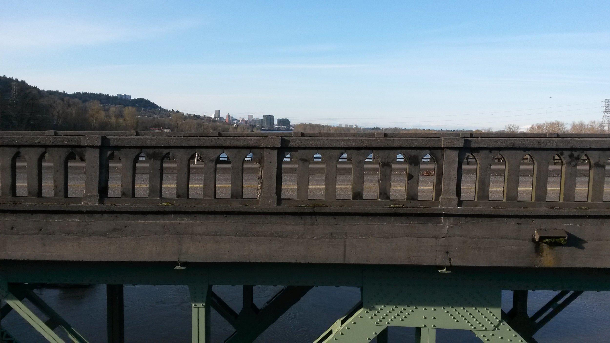
We hopped on the rail trail along the Willamette all the way up to the Sellwood bridge—which just opened last week. Unfortunately, the pedestrian/bike lane on the northbound side wasn’t open yet so we had to sneak by a non-existent shoulder alongside commuters waiting at the bridge stoplight.
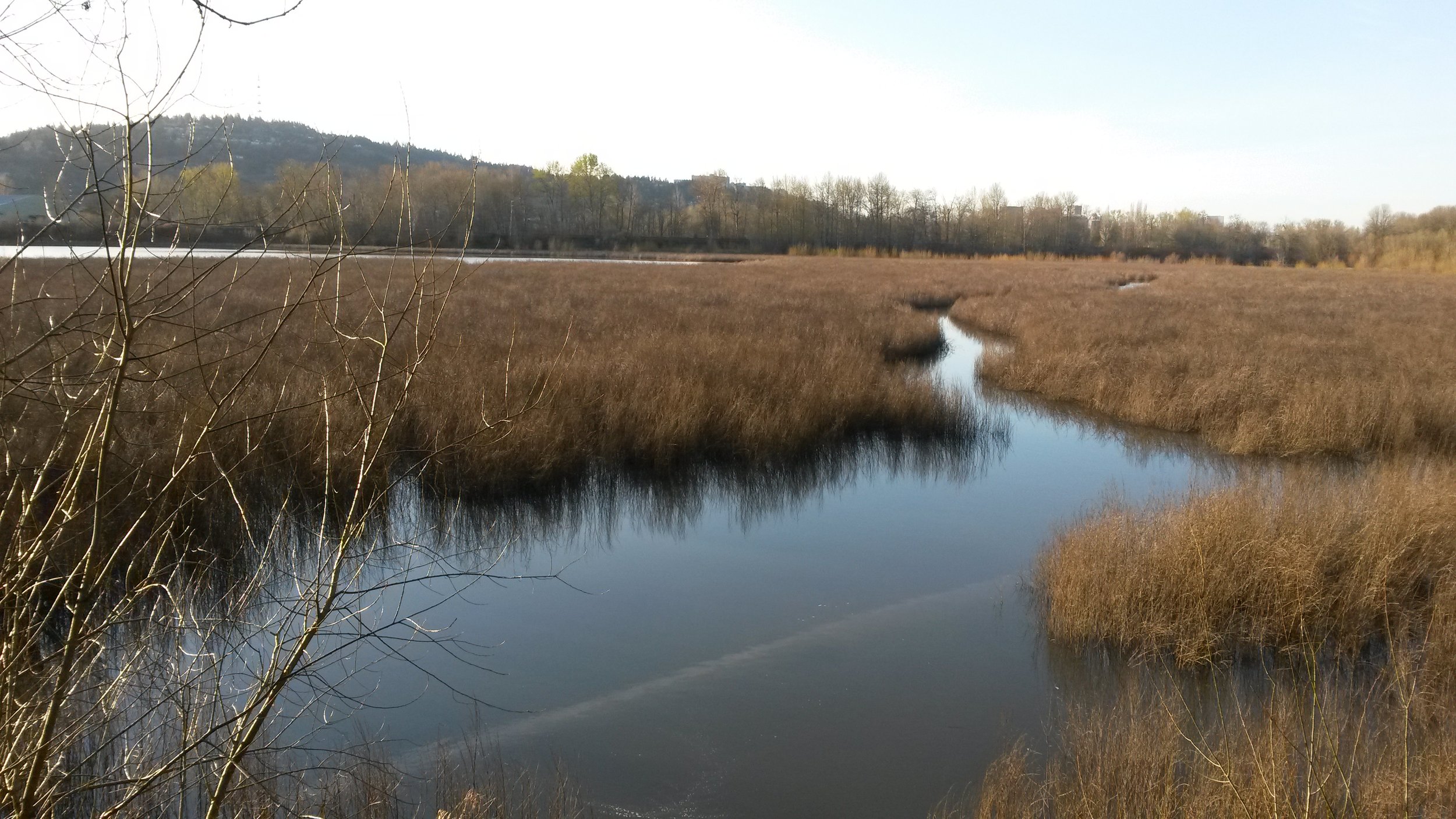
The day ended with gorgeous views of Mt. St. Helens and of the Mausoleum by Oak Bottoms. The end of day light was perfect to walk through this little nature reserve in the middle of the city.
Tomorrow brings a big chunk of the Springwater Trail and Powell Butte. Stay tuned!
Trackbacks/Pingbacks
Portland Urban Hike Day 10: Hiking among Mansions and Treehouse Cathedrals - Liz Thomas: Long Distance Adventure Hiking - […] with the mapping took us back to the Stephens Creek Natural Area and disc golf park that we saw…